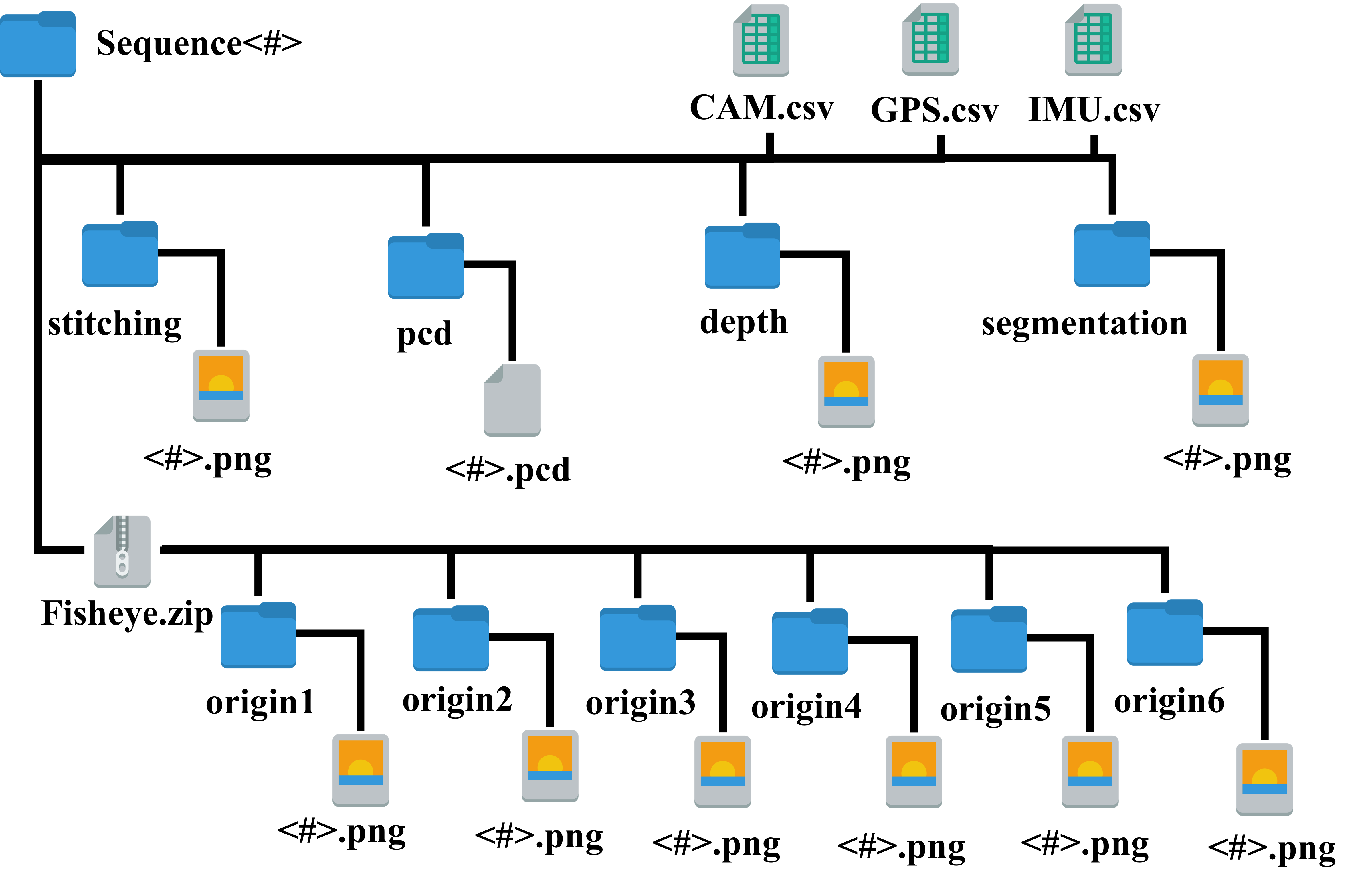
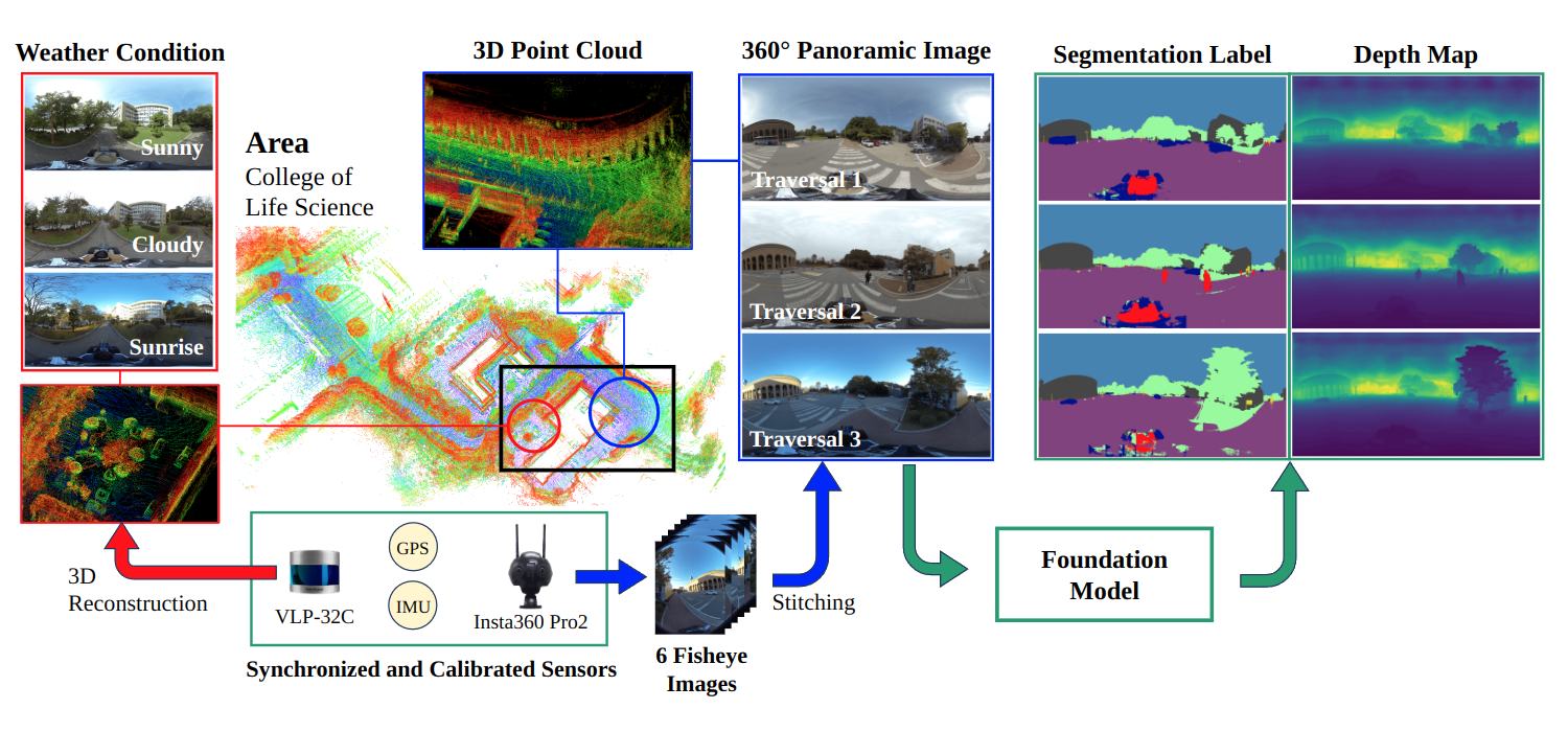
PAIR360 Dataset
- For access to the dataset, please request the password by email.
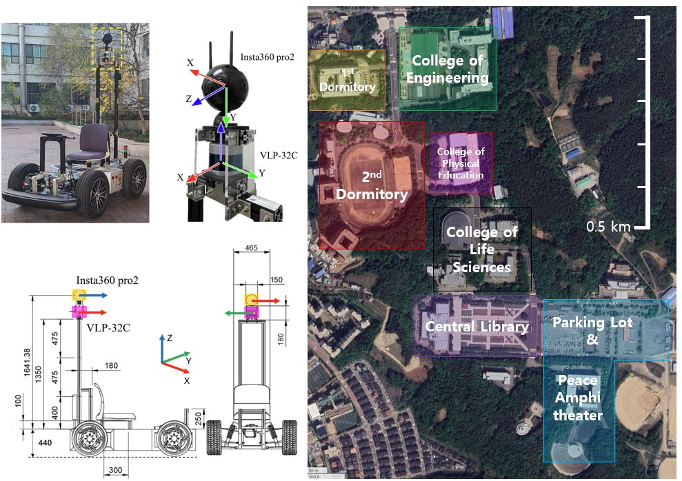
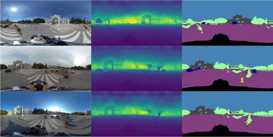
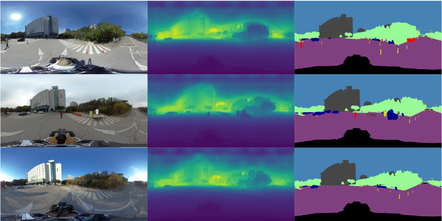
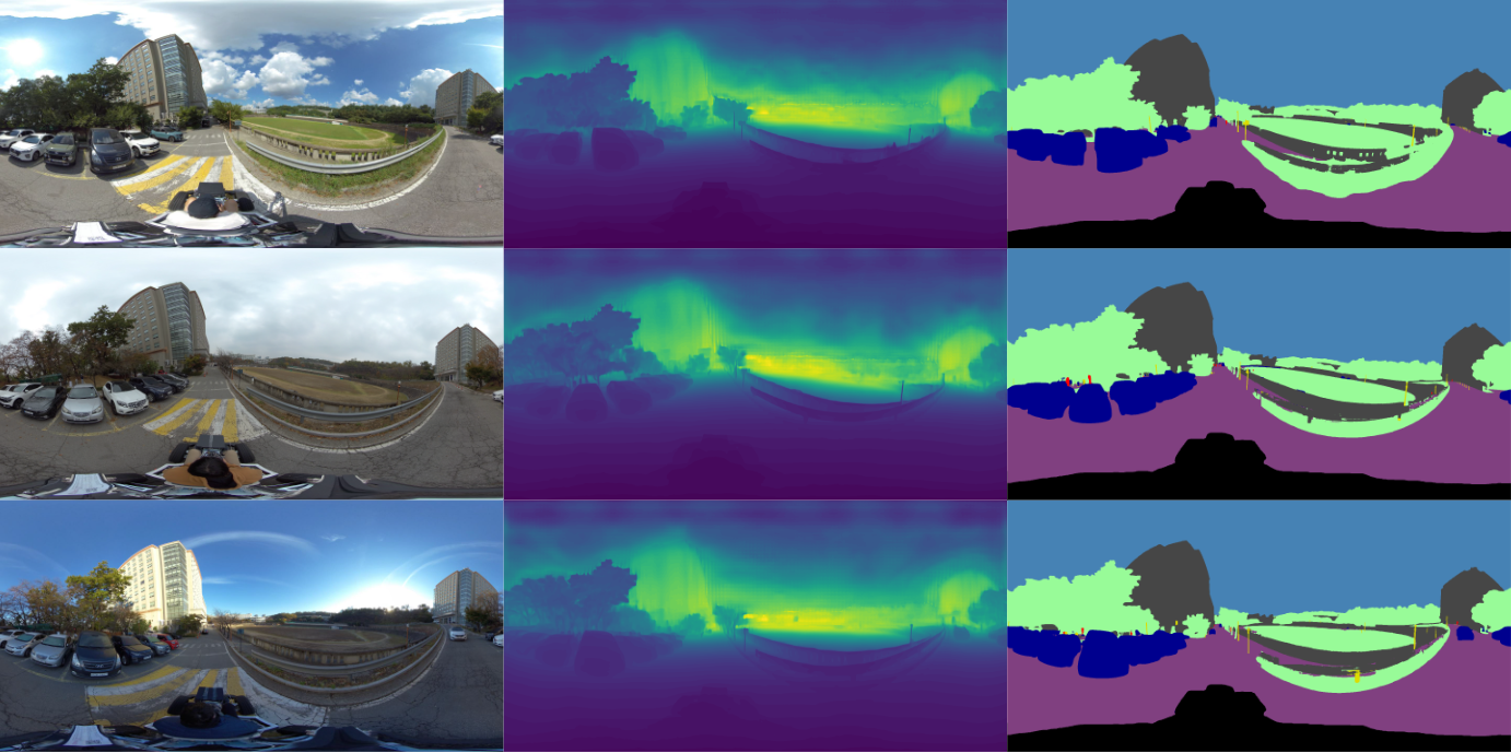
- This dataset provides 360 equirectangular image set with LiDAR point cloud from Insta360 pro2 - Velodyne VLP-32C system.
- Moreover, We use pre-trained foundation model, Depth-Anything, to make depth map and semantic segmentation labels.
Data
- 360 equirectangular images (7680 x 3840)
- RGB
- Depth
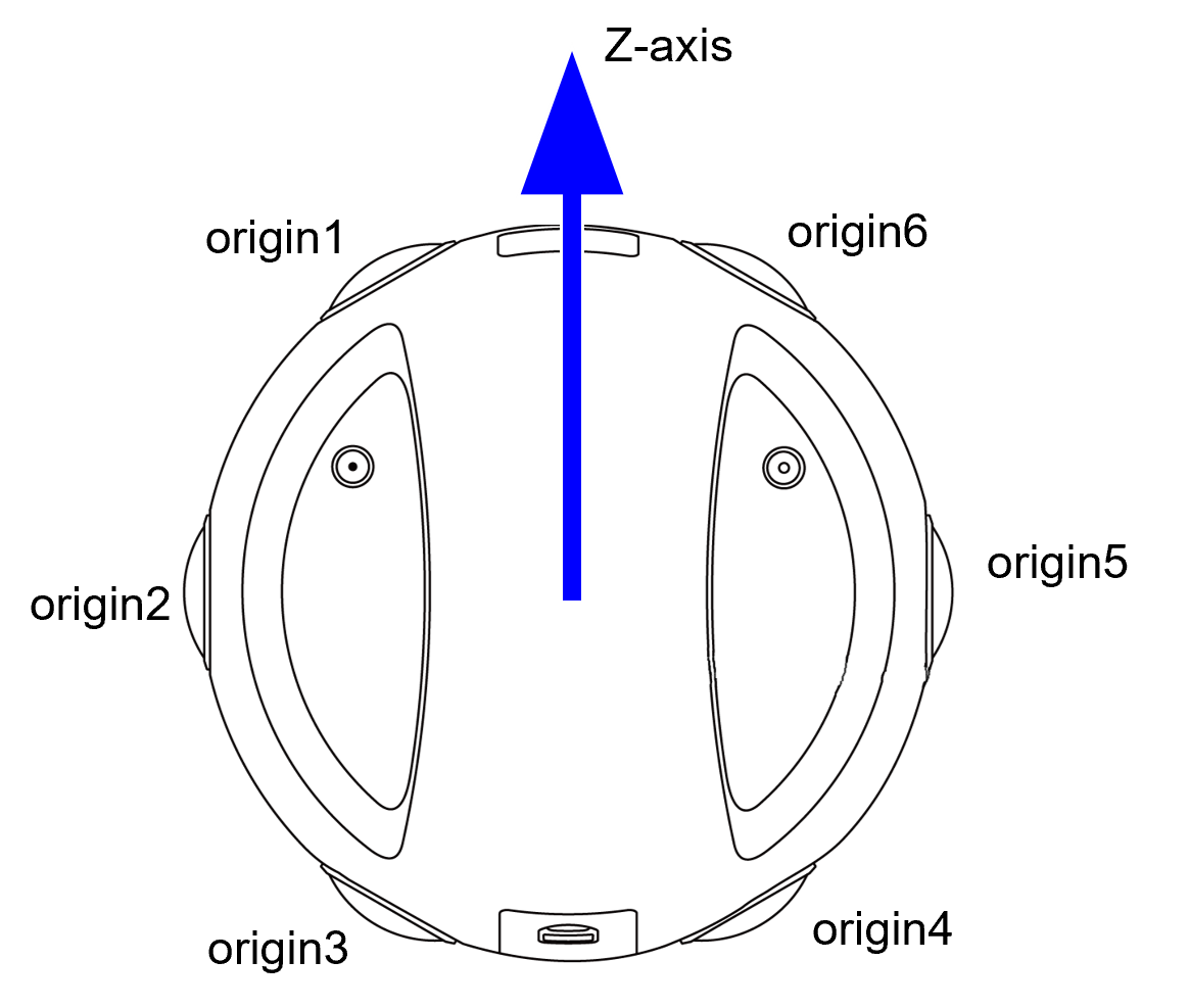
- Fish eye images (3840 x 2880)
- RGB
- LiDAR point clouds (32 channels)
- IMU and GPS
- Panormic annotations
- Semantic segmentation labels
- Depth map
- 3D point cloud map
Weather condition
- Sunny
- Cloudy
- Sunrising
Area
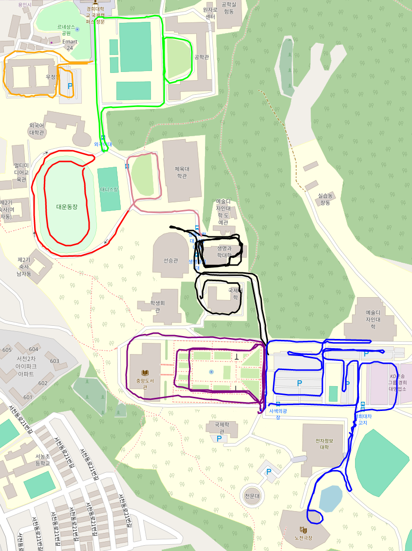
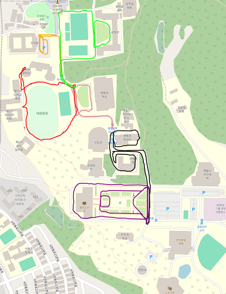
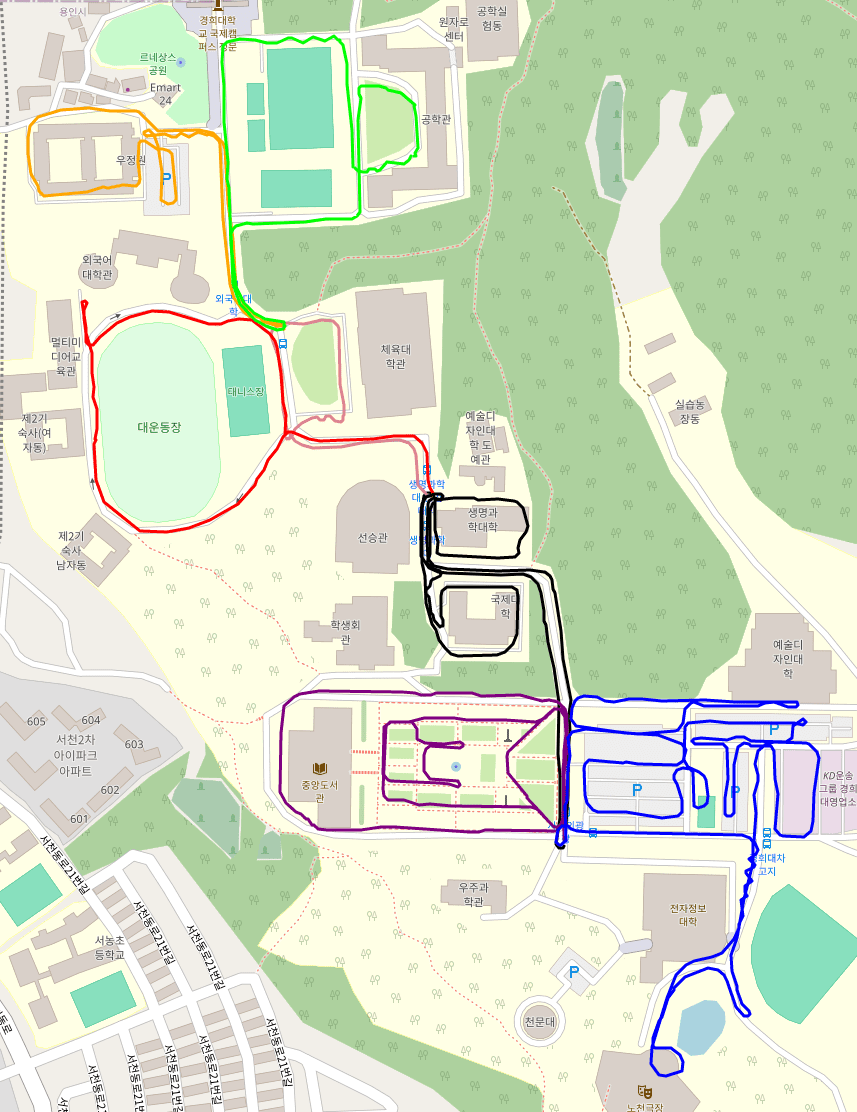
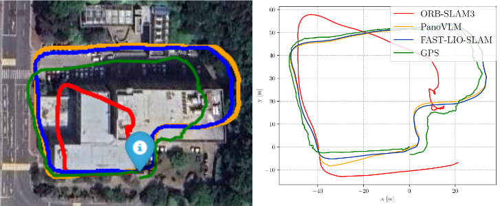
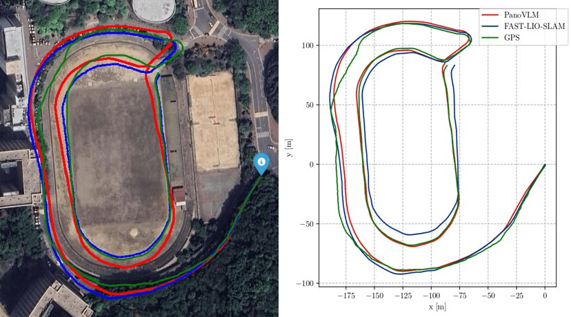
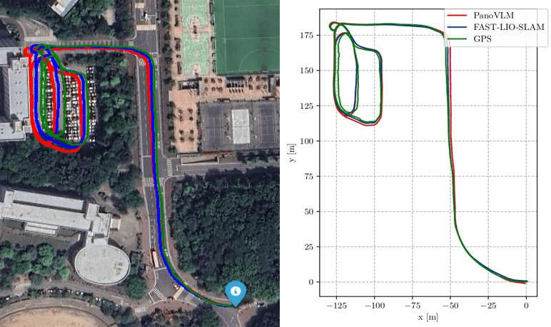
- We capture 7 areas for 3 times in the Kyung Hee University International Campus
- College of Engineering
- College of Life Science
- College of Physical Education
- Central Library
- 1st Dormitory
- 2nd Dormitory
- Parking Lot & Peace Amphitheater